Electoral Constituency Boundaries
A constituency is a subdivision of a municipality or neighborhood democratic council (NDC) for the purpose of local political representation on municipal and neighborhood democratic councils. Each constituency is represented by two elected officials.
Municipalities and neighborhood democratic councils are established by the Ministry of Local Government. Once a municipality or NDC is established, the Guyana's Elections Commission (GECOM) is responsible for delineating constituencies within the council areas.
Click on the links below to view or download constituency maps and shapefiles for each municipality or NDC.
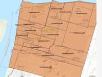 |
City of Georgetown Constituencies (shp) The City of Georgetown is sub-divided into 15 electoral constituencies. This is a shapefile of the 15 constituencies. Data Source: This layer was digitized by GuyNode using map and boundary descriptions from GECOM |
|
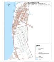 |
Town of New Amsterdam Constituencies (shp) Digitized by GuyNode Data Source: GECOM |
|
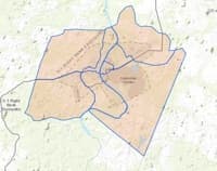 |
Town of Linden Constituencies(shp) Digitized by GuyNode Data Source: GECOM. |
|
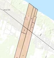 |
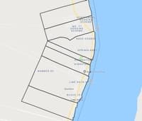
Town of Rose Hall Constituencies(shp)
Digitized by GuyNode |
|
 |
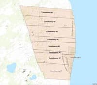
Town of Corriverton Constituencies(shp)
Digitized by GuyNode |
|
 |
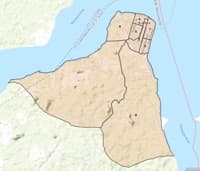
Town of Anna Regina Constituencies (shp) Digitized by GuyNode Data Source: GECOM |
|
 |
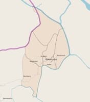
Town of Bartica Constituencies (shp)
Digitized by GuyNode |
|
 |
Town of Mabaruma Constituencies (shp) Digitized by GuyNode Data Source: GECOM, 2016 |
|
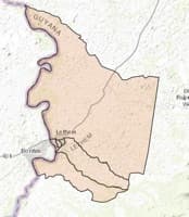 |
Town of Lethem (Constituencies shp) Digitized by GuyNode Data Source: GECOM |
|
 |
Town of Mahdia Constituencies |
| Region 1, NDCs and their Constituencies | ||
| 1. Town of Mabaruma (Web Map) | Official Map (jpg), Land and Surveys Dept | (shp) |
| 2. NDC of Matthews Ridge / Arakaka / Port Kaituma | Official Map (jpg), Land and Surveys Dept | (shp) |
| 3. All of Region 1 | NDC Boundary Descriptions | (shp) |
Region 2, NDCs and their Constituencies
Region 3, NDCs and their Constituencies
| 1. Patentia / Toevlugt | ||
| 2. Canals Polder | ||
| 3. Nismes / La Grange | ||
| 4.Meer Zorgen / Malgre Tout | ||
| 5. Klein Pouderoyen / Best | ||
| 6. Nouvelle Flanders / La Jalousie | ||
| 7. Blankenburg / Hague | ||
| 8. Cornelia Ida / Stewartville | ||
| 9. Uitvlugt / Tuschen | ||
| 10. Vergenoegen / Greenwich Park | ||
| 11. Good Hope / Hydronie | ||
| 12. Parika/Mora | ||
| 13. Leguan | JPG ; PDF | |
| 14. Wakenaam | Web Map; JPG; Source | |
| 17. All of Region 3 |
Region 4, NDCs and their Constituencies
| 1. Cane Grove Land Development Scheme | ||
| 2. Vereeniging / Unity | ||
| 3. Grove / Haslington | ||
| 4.Enmore / Hope | ||
| 5. Foulis / Buxton | ||
| 6. La Reconnaissance / Mon Repos | ||
| 7. Triumph / Beterverwagting | ||
| 8. La Bonne Intention / Better Hope | ||
| 9. Plaisance / Industry | ||
| 10. Eccles / Ramsburg | ||
| 11. Mocha / Arcadia | ||
| 12. Herstelling / Little Diamond | ||
| 13. Diamond / Golden Grove | ||
| 14.Good Success / Caledonia | ||
| 15. Te Huist Coverden / Soesdyke |
Region 5, NDCs and their Constituencies
| 1. Gelderland / No 3 | ||
| 2. Rosignol / Zeelust | ||
| 3. Bel Air / Woodlands | ||
| 4. Woodley Park/Bath | SHP | |
| 5. Naarstigheid/Union | ||
| 6. Tempe / Seafield | Web Map; Source | SHP |
| 7. Rising Sun / Profit | Web Map; Source | SHP |
| 8. Abary / Mahaicony | ||
| 9. Chance / Hamlet | ||
| 10. Farm / Woodlands | Web Map | SHP; PDF |
Region 6, NDCs and their Constituencies
| 1. Jackson Creek / Crabwood Creek | ||
| 2. No.74 Village / No.52 Village | ||
| 3. No.51 Village / Good Hope | ||
| 4.Joppa / Macedonia | ||
| 5.Tarlogie / Maida | ||
| 6. Bush Lot / Adventure | ||
| 7. Hogstye / Lancaster | ||
| 8. Whim / Bloomfield | ||
| 9. John / Port Mourant | ||
| 10.Hampshire / Kilcoy | ||
| 11. Fyrish / Gibraltar | ||
| 12. Borlam ( No.37 ) / Kintyre | ||
| 13. No. 38 / Ordnance Fortlands | ||
| 14. Cane Field / Enterprise | ||
| 15.Black Bush Polder/ New Doe Park | ||
| 16. Enfield / New Doe Park | ||
| 17. Corentyne River |
Region 7, Unestablished NDCs
| 1. Agatash | ||
| 2. Karambaru to Kukui River + Phillipi | ||
| 3. Jawalla, Kubenang River, Kamarang | ||
| 4. Waramadan | ||
| 5. Paruima | ||
| 6. Arau |
Region 8, Unestablished NDCs
| 1. Madhia / Kurubrong River / Mona Falls / Monkey Mountain | ||
| 2. Paramakatoi | ||
| 3. Maripari River | ||
| 4. Kurukabaru | ||
| 5. Kopanang, Waipa, Kenepai Chenapau River Kaibarupai |
Region 9, Unestablished NDCs
| 1. Aranaputa/Upper Burro-Burro NDC | ||
| 2. Annai | ||
| 3. Ireng / Sawariwau ( Including St. Ignatius ) | ||
| 4. Yarong Paru - Good Hope | ||
| 5. Toka - Jakaretinga | ||
| 6. Yakarinta - Wowetta, Surama | ||
| 7. Sand Creek - Dadanawa, Catunarib, Sawariwau Marudi | ||
| 8. Aishalton - Karaudanawa, Achiwib | < |
Region 10, Established and Unestablished NDCs
| 1. Kwakwani / Linden / Coomaka Lands / Ituni | ||
| 2. Mabura Hill | ||
| 3.Makouria River | ||
| 4.Berbice River Settlements / Mora Creek (Aorima) / Hururu |