In 2018, Guyana completed upgrading its Continuously Operating Reference Stations (CORS) Network . The system will continue to be tested until December 2019. The new 8-station system represents a significant development for geospatial applications in Guyana.
The need for a CORS network arises because GPS coordinates contains errors, often between 5-8 meters. CORS is a system for reducing errors in GPS coordinates so that positions can be reported with errors of just a few centimeters from their true positions.
CORS is similar is a type of real time differential GPS (Kairos). A typical differential GPS uses the pseudo random code (PRC) transmitted by GNSS satellites to continuously compute the location of base stations. These computed coordinates are then compared to the known coordinates of the same base stations. The difference between the two sets of coordinates is then broadcasted so that nearby receivers can adjust their GNSS coordinates thereby achieving higher levels of positional accuracy.
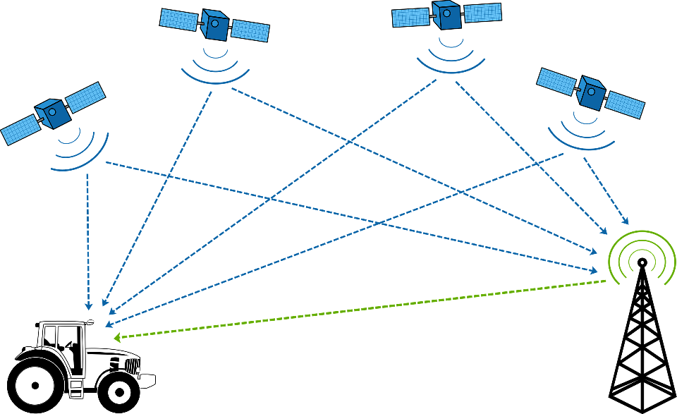
The image below illustrates how differential works. The GPS aboard the tractor is computing its position from signals received from GNSS satellites. It is also receiving data about the amount of GPS error experienced at that location from the tower, which is a base station. The corrections from the base station is used to adjust the GNSS coordinates to arrive at higher levels of accuracy for the tractor position. CORS works off the same general principle, but with some important differences.
CORS Network
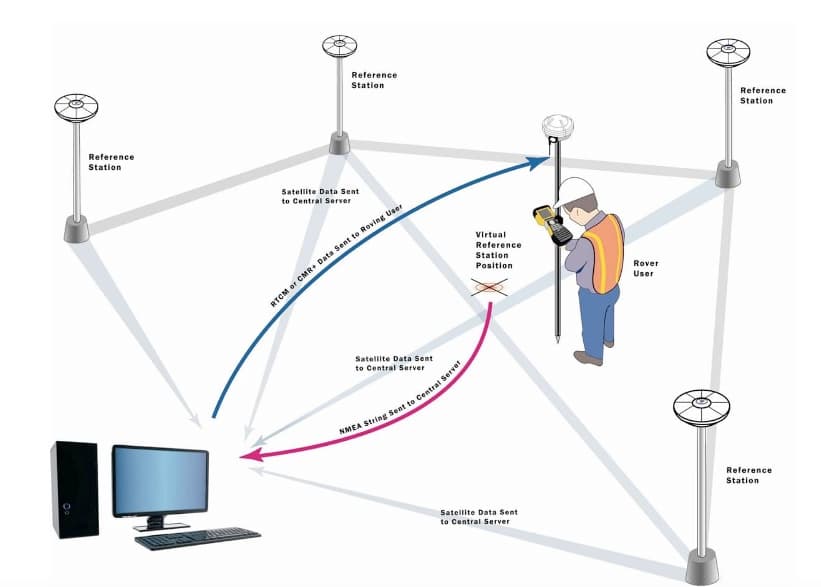
The image below shows the basic structure of a typical CORS network. Similar to differential GPS, the precise coordinates of each base stations are determined beforehand using high accuracy surveying methods. As with differential GPS, the coordinate positions of these base stations are also continuously re-computed from signals received from GNSS satellites. However, instead of using the pseudo random codes (PRC) transmitted by the GNSS satellites to compute the coordinates, CORS base stations use the carrier frequency of the codes to compute the coordinates.
The difference between the known and computed coordinates is sent back to a centralized server to be distributed via internet. It may also be broadcasted via radio so that they can be detected by nearby receivers. In the image below, the user can determine his precise position by collecting coordinates from GNSS satellites and then adjusting those coordinates with data obtained from a virtual reference station created with data from all the base stations in the network. See this video for more information.
Guyana’s CORS Network
Guyana’s new CORS network has 8 stations that are connected to the International Terrestrial Reference Framework (ITRF 2014, Geocentric Reference Systems of the Americas – SIRGAS). The stations are located at Eclipse Falls, Region 1; Supenaam ,Region Two; Georgetown, Region 4; New Amsterdam, Region 6; Olive Creek, Region 7, Lethem, Region 9; and Linden, Region 10.
The National Geodetic Survey of the US maintains a registry of CORS stations in the US in the form of an interactive map. You can take a look at it here. I hope that in that in the near future a similar map can be published for Guyana.
Kaiteur News reported that a few years ago, the PPP administration was the first to start building the CORS network, but the system was never operationalized. Guyana’s new CORS network is being implemented by a British consultancy company named Ordnance Survey International under contract by the current APNU administration. The project cost was $455,000 USD.
The Guyana Lands and Surveys Commission has invited interested professionals to contact the Commission’s Head Office for information about how to use the system. However, it would be more helpful if this information is posted on the Commission’s webpage. That way, more people might be encouraged to use the system.
Basic Consumer GPS Usage
Most people use GPS for vehicle navigation or to determine their location. For these types of usages, centimeter-level precision is not necessary and 1 or even 2 meters of errors may be acceptable. Basic consumer usage of GPS in Guyana will not be affected by the new CORS network, as the high precision of this system is not needed for these applications.
The people who will need CORS-corrected GPS data are land surveyors, engineers, geologists, and other scientists whose work require extremely high level of accuracy. For example, CORS data will definitely play a huge role in precisely demarcating property boundaries, thus the country’s land information system will be more reliable.
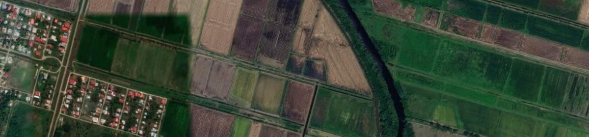
In agriculture, GPS aboard tractors and combines can be used to guide things like ploughing, chipping, seeding, harvesting crops and applying agrochemicals.
GuyNode will provide links to technical information on Guyana’s new CORS network as soon as this information becomes more available.